Dr. Chan Lai Leo
Associate Director, State Key Laboratory of Marine Pollution
Victoria Harbour was a highly developed area with water pollution in the past, which was caused by discharging sewage and reclamation projects. To rectify the problem, the Hong Kong SAR Government implemented the Harbour Area Treatment Scheme (HATS) to collect and treat the wastewater. The scheme had implemented to phase 2a, aiming to improve water conditions, coupled with the cessation of reclamation. However, a comprehensive and systematic investigation into the distribution, extent, diversity, and coverage of coral communities within the harbour has not been conducted.
With the funding support from Environment and Conservation Fund of the Hong Kong SAR Government, Professor Leo Chan, Associate Director of the State Key Laboratory of Marine Pollution (SKLMP), City University of Hong Kong (CityU) and his team conducted the first ever comprehensive underwater survey on benthic ecosystems in Victoria Harbour, providing valuable insights into their health status and recovery trajectory. The study, which encompassed the natural coastlines of Victoria Harbour, including the eastern part near Tseung Kwan O and Hong Kong Island, employed an innovative underwater mapping technique to comprehensively assess the habitat's status (Figure 1). This included the application of a sea drop camera for screening of the natural benthic habitats, an underwater information system (UWIS) for underwater mapping, a geographical information system (GIS) and computational estimation of coral coverage.
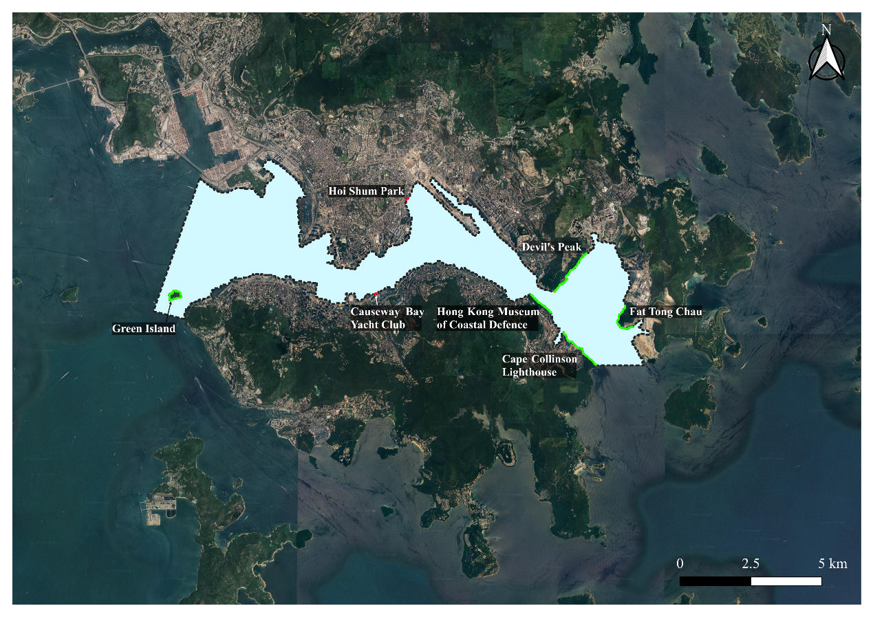
Figure 1:The location of Victoria Harbour (blue area). Green line represents the natural coastline with the presence of benthic habitat, the red line represents the natural coastline without benthic habitat.
The study was focused on two location types, including the artificial breakwater and natural coastline in Victoria Harbour. The study had been carried out with one preliminary survey and a three-tier survey design, so that the benthic habitat could be screened out in the area.
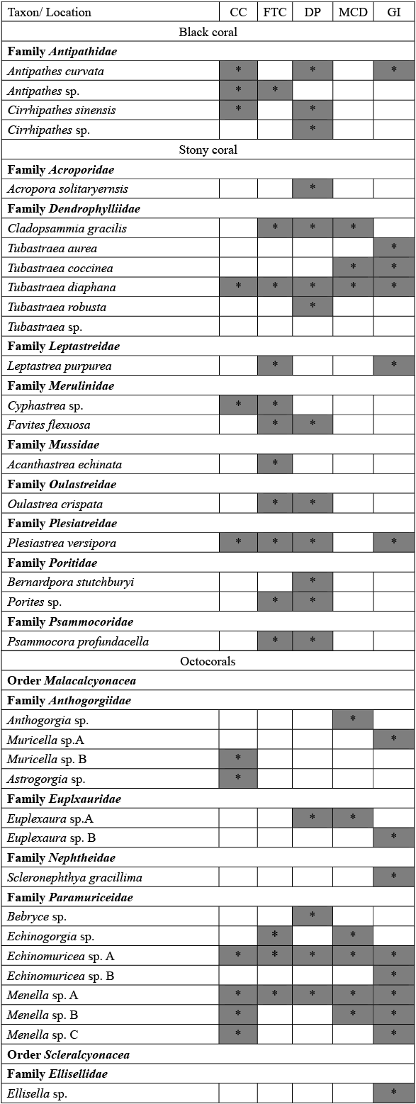
The survey reported a total of 35 sessile epifauna species in Victoria Harbour. Among these, researchers recorded four black coral species, 16 Scleractinia coral species, and 15 octocoral species, revealing a rich biodiversity within the harbour area. (appendix 1) These findings underscore the potential for the recovery of benthic habitats and the restoration of marine ecosystems in the vicinity.
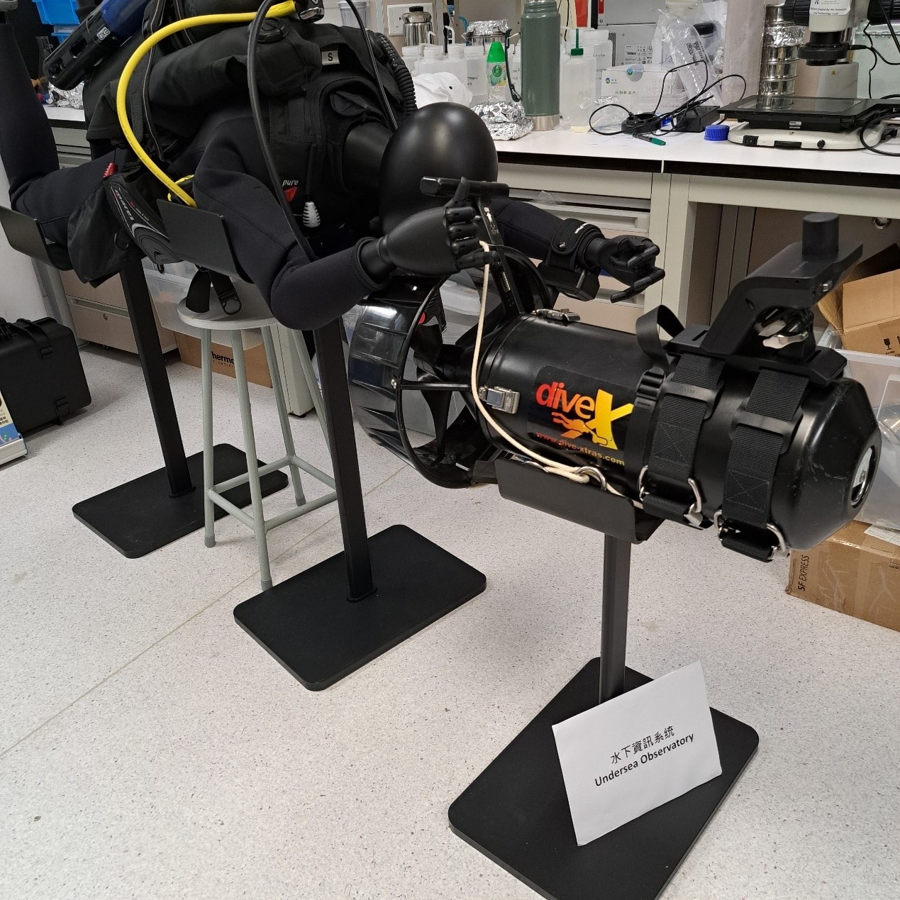
Figure 2: Undersea Observatory system.
Through the mapping survey, 5 locations were identified as essential benthic habitats, including Cape Collinson Lighthouse, Fat Tong Chau, Devil’s Peak, Hong Kong Museum of Coastal Defence and Green Island. The largest benthic habitat is discovered in Fat Tong Chau, and the area is even to an area of approximately 10.42 hectares (as large as 14.6 standard soccer pitches), while the smallest habitat covered 2.02 hectares in the Hong Kong Museum of Coastal Defence.
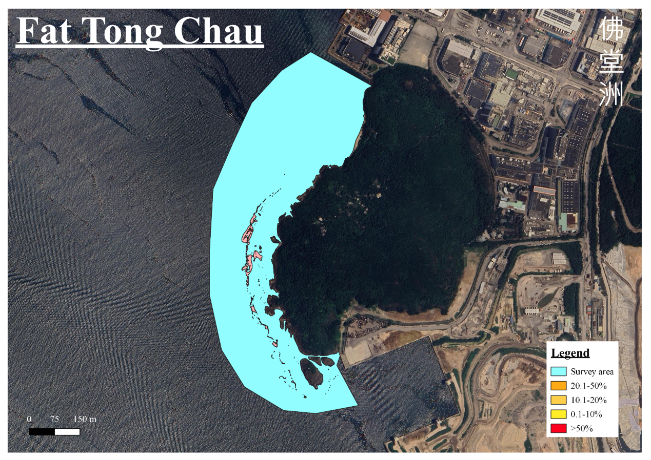
Figure 3: Mapping result of Fat Tong Chau, habitat area is 10.42 hectare. Blue area represents the survey area, while other colors represent the percentage of the coral coverage.
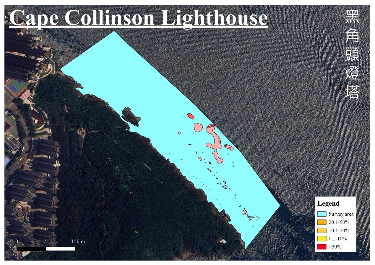
Figure 4: Mapping result of Cape Collinson Lighthouse, habitat area is 3.25 hectare. Blue area represents the survey area, while other colors represent the percentage of the coral coverage.
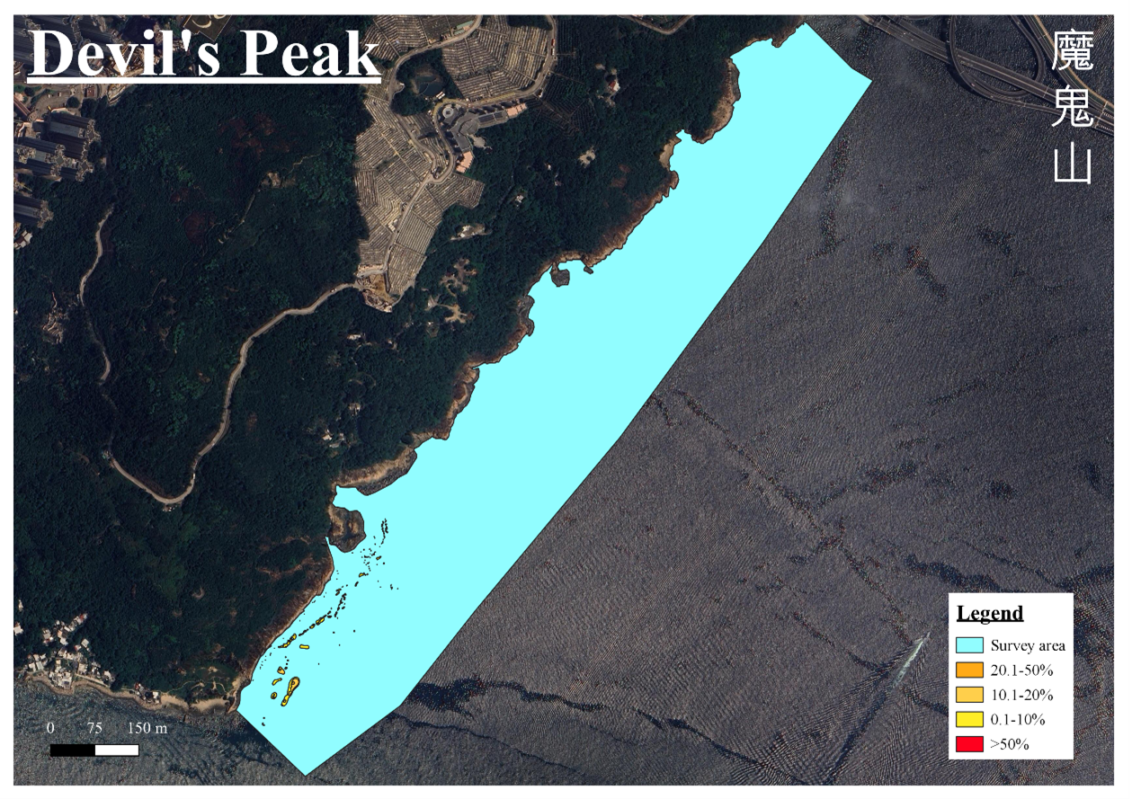
Figure 5: Mapping result of Devil’s Peak, habitat area is 2.99 hectare. Blue area represents the survey area, while other colors represent the percentage of the coral coverage.
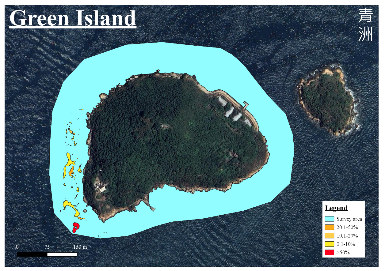
Figure 6: Mapping result of Green Island, habitat area is 2.45 hectare. Blue area represents the survey area, while other colors represent the percentage of the coral coverage.
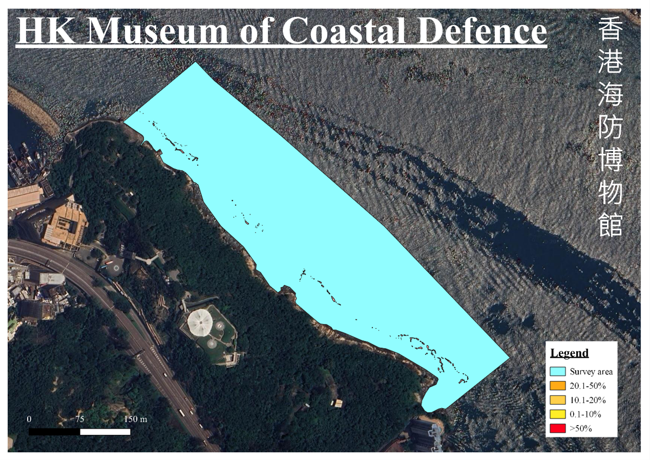
Figure 7: Mapping result of Hong Kong Museum of Coastal Defence, habitat area is 2.02 hectare. Blue area represents the survey area, while other colors represent the percentage of the coral coverage.
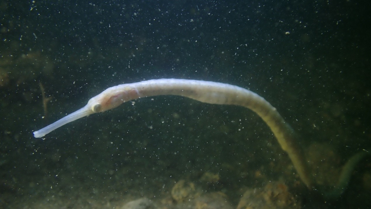
Figure 8: Discovery of Double-ended pipefish Trachyrhamphus bicoarctatus at Hong Kong Museum of Coastal Defence.
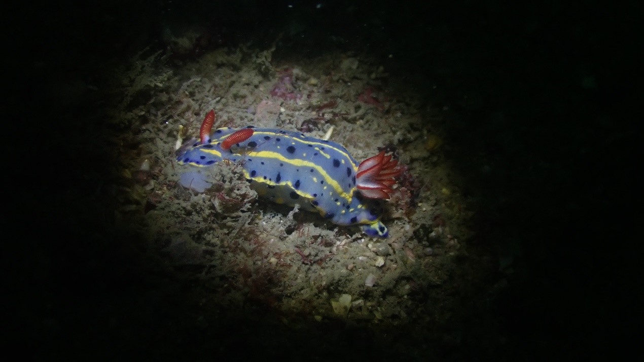
Figure 9: Discovery of Festive Sea Slug Hypselodoris festiva at Hong Kong Museum of Coastal Defence.
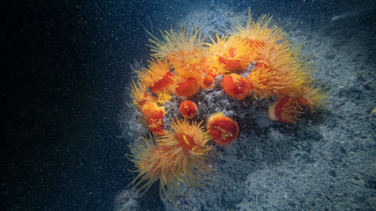
Figure 10: Sun coral in Devil’s Peak.
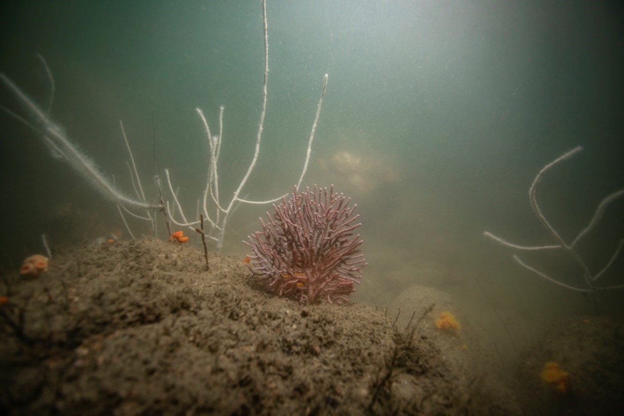
Figure 11: Octocoral in Devil’s Peak.
The inspiring finding provided evidence for the effectiveness of HATS and provided information for the conservation of the ocean region in Hong Kong. The findings can act as a monitoring use for Hong Kong marine environment and the map-sharing with the public will have a positive effect on reducing the damage to corals.
Appendix 1
List of corals recorded according to taxon, CC = Cape Collinson Lighthouse, FTC = Fat Tong Chau, DP = Devil’s Peak, MCD = Hong Kong Museum of Coastal Defence, GI = Green Island.
Other findings of organisms
- High density of scallops was found in Fat Tong Chau
- Trachyrhamphus bicoarctatus (Benstick Pipefish) was found in Hong Kong Museum of Coastal Defence
- Hypselodoris festiva (Festive Sea Slug) was found in Hong Kong Museum of Coastal Defence
*If more photos and information related to the research are required, please contact State Key Laboratory of Marine Pollution for more details. (Phone: 3442 6506, Email: sklmp.info@cityu.edu.hk)